Hike to the Glacial Lakes in Piedmont
Piedmont is one of the most beautiful Italian regions when it comes to hiking. The very beautiful hike in the high mountains of Piedmont begins at the source of the Po at Pian del Re and leads to four glacial lakes at an altitude of over 2000 meters. The tour lasts about three hours and leads to the alpine lakes Lago Superiore, Lago Lausetto, Lago Chiaretto and Lago Fiorenza.
Hiking in Piedmont, Monviso, from Pian del Re to the Alpine Glacial Lakes
Circular hike in Piedmont at the foot of the Monviso. The hike begins at Pian del Re at an altitude of 2020 meters and leads to the impressive glacial lakes that feed the Po river.
You need sturdy hiking shoes with a good profile and hiking sticks if possible. The tour is sometimes very steep and you have to cross a waterfall on a rope. But you will be surprised with a wonderful nature at the glacier lakes with a high alpine flora and fauna.
Description of the Hike in Piedmont to the Galcial Lakes
- Duration: 3 Hours without lunch break and detours
- Difficulty level: 3 out of 5
- Distance: 7.2 km
- Minimum altitude: Pian del Re 2020 m
- Maximum altitude: 2406 m (Lago Superiore)
- Total climb: 538 m
- Descend: 538 m
Starting Point Pian Del Re
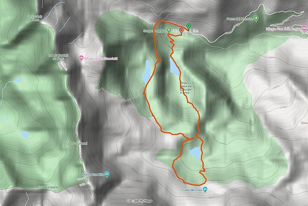
The hike begins at Pian del Re, where the Po originates in Piedmont. To the left of the parking lot, follow the GTA V16 signpost towards Buco del Viso / Colle delle Traversette.
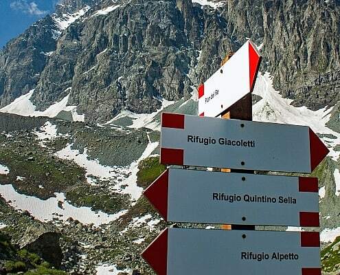
After a few 100 meters, turn left onto the path towards Rifugio Giacoletti (V17). Now the climb to the upper lake Lago Superiore begins. Already on the way up you have a beautiful view of the valley of the Po up to the Mombracco.
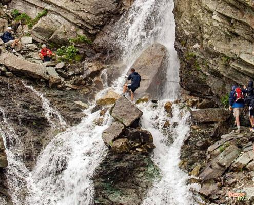
Through the Waterfall
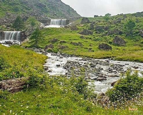
The path leads through a waterfall. The cascade flows from the upper lake into the valley and is stronger when the snow melts. In winter, the cascades are frozen to ice. On ropes and a safety chain you shimmy through the cascades and have to put up with a few splashes. If you take a wrong step on the slippery stones, your feet will be wet.
Around the Glacial Lakes
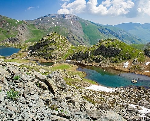
The path now leads steeply upwards and hiking on the ridge, you can see the Lago Fiorenza from above. After a few minutes you can reach the large glacier pool with Lago Superiore at an altitude of 2339 meters.
Over meadows you leave the path towards Rifugio Giacoletti and turn right to the small Lago Lausetto at 2360 meters.
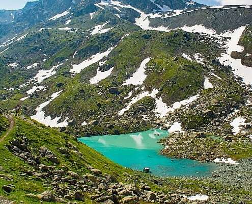
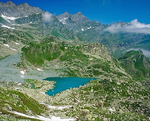
We continue towards the hill that separates the basin of the two lakes from the main valley. Below is the heart-shaped Lake Chiaretto at an altitude of 2275m. The glacier lake has turquoise transparent water and is fed by melt water and minerals.
Where the hiking trails cross towards Rifugio Giacoletti and Rifugio Quintino Sella, you turn down the valley and pass Lago Chiaretto from the other side.
On the way back, you will come across a plain right at Lago Fiorenza at an altitude of 2111 meters. From here it is only 20 minutes downhill to the Pian del Re.
Why Hiking in Piedmont to the Glacial Lakes with milano24ore?
Included Services
We provide a Piedmont authorised Mountain Guide that speaks your language. Our guide will accompany you on this hike. He or she will give you interesting details on the way and draws your attention to the special flora and fauna. This will give you some insight about the Monviso in the Piedmont and the Okzitan culture.
Additional Services
- Overnight stays with breakfast and dinner at Mountain Inn Pian del Re or Hotel Colletta
- Pre-paid lunch at Mountain Inn Pian del Re (reservation required)
- Tour extensions with a regional wine tasting tour
- Private transfers
Exclusive and in Your Language
The hiking tour in Piedmont is organized only for you and your fellow travelers. They are conducted in the language you choose. We have experienced local guides for Italian, English, French. Other languages on request or with interpreter.
Pricing
The above price has been calculated for a group of 8 participants on a 3 hour hike. Please let us know the number of participants and special wishes with your request.
Arrival and Meeting Place
Your guide can meet you at Pian del Re or at another hotel in Piedmont. We can organise a transport to the meeting point and collect you from the end point.
Stages of the Hike
Pian del Re, 2020 meters altitude
The official source of the Po is at Pian del Re. The inscription “Qui nasce il Po” is found on a stone. The sources of the tributaries from the higher glacial lakes converge on the Pian del Re. A little further uphill you come to the glacier lake Lago Fiorenza and the azure alpine lakes further up.
Lago Superiore di Viso 2313 m
The Lago Superiore gets its name from its highest position of the alpine lakes, although the smaller Lago Lausetto with 2324 meters is even a few meters higher.
Lago Chiaretto 2261m
The glacier lake has a great heart shape and impresses with particularly clear and turquoise water. The Lago Chiaretto is mainly fed by the Coolidge glacier, whose water gets its turquoise color due to minerals.
Lago Fiorenza 2153m
The lower of the alpine lakes is on a large plateau that is rich in vegetation. In summer there is a playground on the banks for day trippers and families for a picnic. Fish swim in Lago Fiorenza, so you can even see anglers on the edge. With a little luck, you can see the extremely rare black salamander on the shore.
Other Interesting Offers for Individual Travelers and Groups by milano24ore
Private Travel Group Travel


